Inner Mongolia
Chapter 1: City Overview
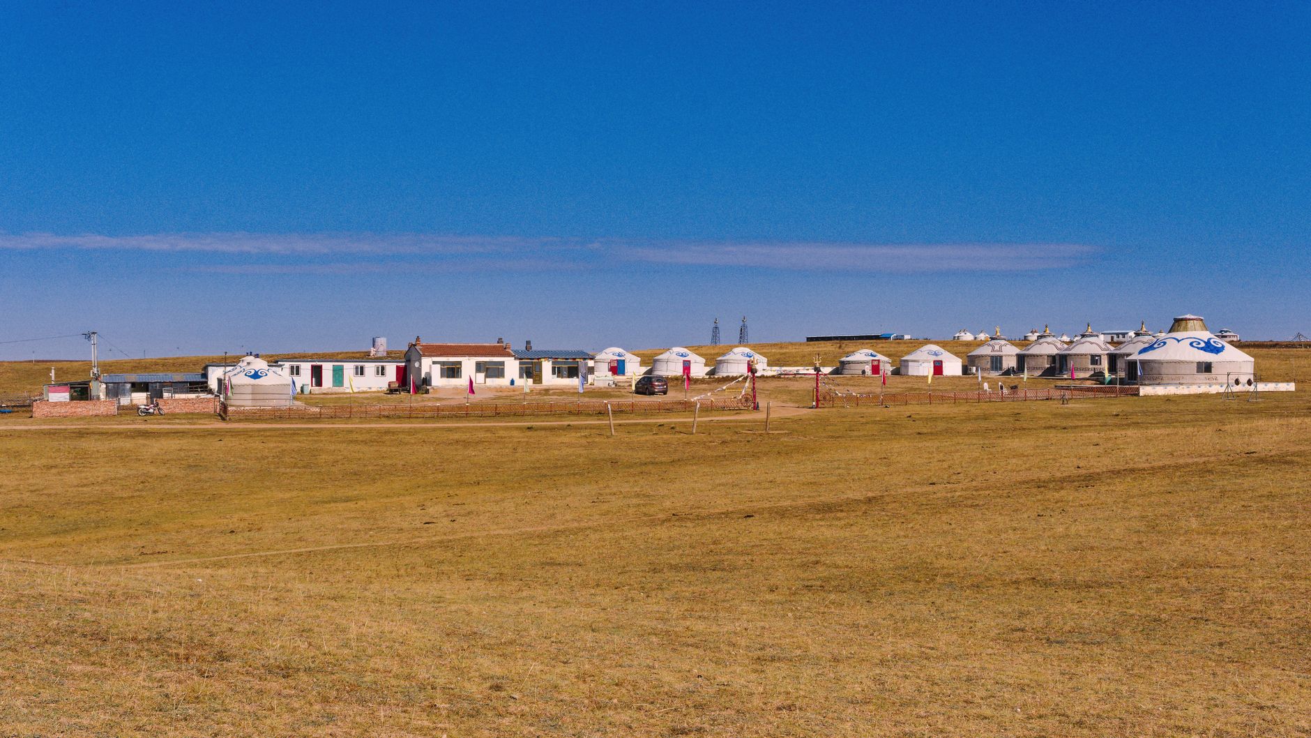
The Inner Mongolia Autonomous Region, situated in the far north of China, stretches across the northern frontier like a prancing steed with its head raised high. It borders Heilongjiang, Jilin, and Liaoning to the east, Hebei, Shanxi, Shaanxi, and Ningxia to the south, Gansu to the west, and Russia and Mongolia to the north, with a border of over 4,200 kilometers—accounting for nearly one‑fifth of China’s total land boundary. From Hulun Buir in the east to Alxa in the west, it is China’s provincial‑level administrative region with the greatest east‑west span; the sun takes two full hours to travel from its eastern edge to illuminate the western Gobi.
The main body of this land is the vast and open Inner Mongolian Plateau, averaging about 1,000 meters above sea level. The Yin Mountains run east‑west along its southern rim, the Greater Khingan Range stretches north‑south in the east, and the Helan and Langshan mountains rise in the west. The Yellow River enters the region from Shizuishan in Ningxia, loops around the Ordos Plateau in a giant “Π” shape, nurturing the fertile Hetao Plain—known as the “Jiangnan beyond the Great Wall.” The Erguna, West Liao, and Nen rivers feed the vast forests and grasslands in the east. From east to west, the landscape shifts successively through forest, grassland, and desert, forming a magnificent pattern of “forests and iron in the east, grain in the south, and livestock in the north.”
Inner Mongolia covers a total area of 1.183 million square kilometres, ranking third among China’s provinces. Its permanent population is about 23.96 million (end‑2023), epitomising a region of vast space and small settlements. Administratively, Inner Mongolia was the first area in China to implement ethnic regional autonomy: on 1 May 1947, the Inner Mongolia Autonomous Government was established in Wangye Temple (now Ulanhot, Hinggan League)—two years before the founding of the People’s Republic—and the capital was later moved to Hohhot. As a “model autonomous region,” it is home to 55 ethnic groups, including Mongol, Han, Daur, Evenki, and Oroqen. The main minority, the Mongols, number about 4.24 million, accounting for roughly 17.7% of the region’s total population, and their generations‑old nomadic culture forms the region’s most distinctive soul.
Inner Mongolia has no single nickname, yet it goes by many names: ancients called it “beyond the passes” (Saiwai), because it lay outside the Great Wall from the perspective of the agrarian civilisation to the south; the Mongols call themselves “the cradle of herders,” where the long song and the sound of hoofbeats form the background of life; today it is often referred to as “the splendid scenery of the northern frontier,” serving as Beijing’s “back garden” and a vital ecological security barrier for northern China. The capital Hohhot is also known as “Green City” (Qingcheng), after the Daqing Mountains on its outskirts. But no matter from which angle you approach Inner Mongolia, it ultimately reduces to one colour—green, the boundless backdrop of the August grasslands and the perennial hope of this high plateau.
Chapter 2: Historical Context
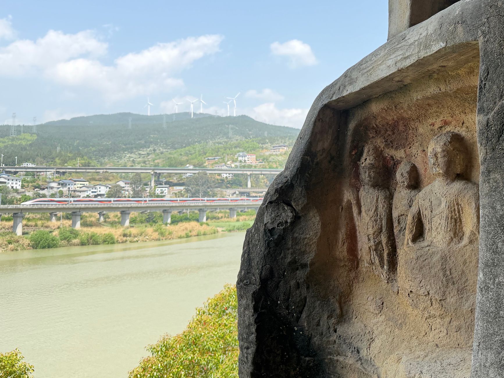
The Inner Mongolian region is one of the cradles of nomadic civilisation in Asia and has been the central stage for successive northern ethnic groups in Chinese history. Human activity here dates back to the late Palaeolithic. The Dayao culture site (about 700,000 years ago) and the Ordos Man (about 50,000–37,000 years ago) provide evidence that this area was an important zone for human origins and early migrations.
Phase I: Xiongnu and the Han‑Xiongnu confrontation (3rd century BCE – 2nd century CE)
During the Warring States period, the Xiongnu rose in the Yin Mountains. Touman Chanyu established his court on the Hohhot Plain, and Modu Chanyu unified the steppe tribes, confronting the Qin and Han dynasties. The Qin built the Great Wall, and Emperor Wu of Han sent Wei Qing and Huo Qubing to attack the Xiongnu, with the stage set on the grasslands and frontier passes north and south of the Yin Mountains. The story of Wang Zhaojun’s marriage to the Xiongnu took place here; it is said that her footprints remain at the “Green Tomb” (Qingzhong) on the southern outskirts of Hohhot. The Yin Mountains rock paintings from this period—tens of thousands of carvings—record hunting, sacrificial rites, and warfare scenes, serving as a history book carved in stone.
Phase II: The rise of the Xianbei, Turkic, and Khitan peoples (3rd – 12th centuries)
After the Eastern Han, the Xianbei took over the steppe. In the 3rd century, the Tuoba Xianbei set out from the Gaxian Cave deep in the Greater Khingan Range, gradually migrating south to establish the Northern Wei dynasty and enter the Central Plains. The Gaxian Cave site, in present‑day Oroqen Autonomous Banner, still contains a stone inscription recording the Northern Wei emperor’s ancestral sacrifices—tangible proof of the Xianbei’s origins. Later, the Turks, Uyghurs, and Khitans successively dominated the steppe. The Khitan founded the Liao dynasty, with its Supreme Capital, Linhuang Prefecture, at present‑day Lindong Town in Bairin Left Banner. The Liao creatively established a dual‑track administration “ruling according to customs,” which had a profound impact on later dynasties. The Jurchen‑led Jin dynasty built the “Jin Frontier Wall” stretching thousands of li across the steppe; these defences still wind across the northern landscape today.
Phase III: The golden age of the Mongolian Plateau (13th – 16th centuries)
In 1206, Temüjin unified the Mongol tribes and was proclaimed Genghis Khan at the source of the Onon River. From the banks of the Erguna, the Mongol Empire’s hooves thundered across Eurasia. After Kublai Khan established the Yuan dynasty, he built Xanadu (Shangdu) on the Jinlianchuan grassland in present‑day Zhenglan Banner. This steppe capital—comprising palaces, an imperial city, an outer city, and suburbs—was once the heartbeat of the world, the prototype of Marco Polo’s “Golden Palace of the East.” In 2012, the Xanadu site was inscribed as a UNESCO World Heritage Site. After the fall of the Yuan, the Mongols withdrew to the steppe; Dayan Khan briefly reunified them, and his grandson Altan Khan made peace with the Ming and built Kuku‑Khoton (Hohhot) in 1581, meaning “Blue City”—the beginning of today’s capital.
Phase IV: The Qing‑era league‑banner system and the “Going West of the Pass” (17th – early 20th century)
The Qing dynasty incorporated the Mongol tribes through marriage alliances and the league‑banner system, demarcating each banner’s grazing lands and shifting pastoral society from free roaming to rotational grazing within fixed boundaries. At the same time, peasants from Shanxi and Shaanxi, driven by poverty, poured into southern Mongolia to cultivate land—the “Going West of the Pass” (Zou Xikou) migration was in full swing. Guihua City (the old town of Hohhot) and Baotou gradually grew into important frontier trading centres. Han cultural infusion brought farming, Shanxi opera, and Errentai (a local folk duet), creating a unique blend of agriculture and pastoralism, and a deep fusion of Mongol and Han cultures.
Phase V: Birth and development of the Inner Mongolia Autonomous Region (1947–present)
On 1 May 1947, the Inner Mongolia Autonomous Government was established, the first region in China to implement ethnic regional autonomy. Its capital was later moved to Hohhot. Subsequent administrative adjustments—the incorporation of Suiyuan Province in 1954 and parts of Rehe and Gansu in 1956—shaped the present‑day east‑west expanse. This journey itself embodies China’s important experiment in ethnic regional autonomy, with countless builders arriving from all over to construct Baotou Steel, reclaim farmland, and write the prologue of modern Inner Mongolia.
Chapter 3: Cultural Heritage
Inner Mongolia’s culture is a double‑stringed instrument: one string is the ancient echo of Mongol nomadic civilisation, the other the contemporary harmony of multi‑ethnic integration.
A living linguistic and dialect map
The distribution of dialects in Inner Mongolia is a living fossil of ethnic migrations and administrative history. Among the Han population, Jin dialects prevail in the west—in Hohhot, Baotou, and Ordos—with a crisp, hard pronunciation that preserves entering tones, a linguistic imprint left by the Shanxi‑Shaanxi migrants of the “Going West” era. In the east, Chifeng and Tongliao speak Northeastern Mandarin, reflecting the immigration from Shandong and Hebei during the late Qing “Chuang Guandong” (Journey to the Northeast) movement. At the western end, Alxa dialect belongs to the Lanyin Mandarin group, connecting with Gansu and Ningxia. The Mongolian language, one of the region’s statutory languages, belongs to the Altaic Mongolic family, with dialectal differences between Central (Chakhar), Eastern (Khorchin), and Western (Oirat) varieties. The bilingual road signs and the everyday switching between Mongolian and Chinese create Inner Mongolia’s unique soundscape.
Folk traditions: reverence and revelry
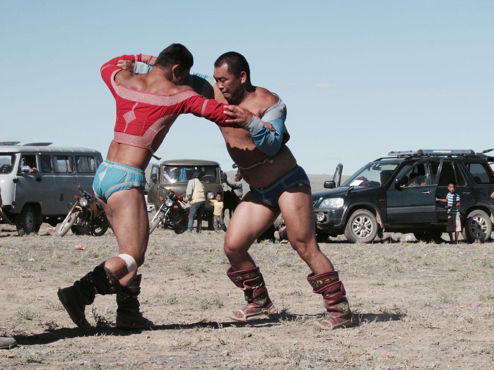
The Naadam Festival is the steppe’s grandest celebration. In Mongolian, naadam means “entertainment” or “game.” Originating as military‑sports reviews under Genghis Khan, it has evolved into a popular festival encompassing three main sports: horse racing, bökh (Mongolian wrestling), and archery. Naadam is usually held in July–August, when the grass is lush; hundreds of white tents dot the prairie, hoofbeats drum, and wrestlers perform the powerful “eagle dance.” Sacrificing to the obo (a stone cairn) is a vestige of Mongol nature worship—obos served as roadside markers and boundary signs, and were also believed to be dwelling places of spirits. During rituals, people circle the obo three times clockwise to the chanting of lamas, adding stones and offering sacrifices for favourable weather. Mongolian weddings, such as the “Ordos Wedding,” an intangible heritage ceremony, can last several days, featuring the groom carrying a bow to fetch the bride, singing duels at the gate, and snatching a sheep’s head—all in a lively atmosphere. In religion, most Mongols adhere to the Gelug school of Tibetan Buddhism, while traces of shamanism remain—such as reverence for the “Eternal Blue Sky,” fire worship, and sacrifices to ongon (ancestral spirits).
Artistic expressions: the heavenly sounds of the steppe
The Mongols have infused music into their very being. The Mongolian Long Song (Urtin duu) imitates the vastness of the grasslands with its long, free‑flowing melodies—a UNESCO Intangible Cultural Heritage of Humanity; a single phrase can stretch for over a dozen beats, like a horizon without end. Khöömei (throat singing) is even more extraordinary: one person produces two distinct vocal parts simultaneously, with low tones like the earth’s rumble and high notes like skylarks’ twittering. The horse‑head fiddle (Morin khuur)—the king of steppe instruments, carved with a horse’s head at the top—has a deep, melancholic tone; master players can summon the thunder of ten thousand galloping horses with a single bow stroke. In the eastern Khorchin region, the Andai dance was originally a shamanic ritual to drive away illness; men and women, young and old, wave red silks and stamp around bonfires with exuberant energy. Among Han immigrant areas, Errentai (a two‑actor folk song‑and‑dance duet) thrives in the countryside, with its clowns and witty repartee drawn from daily life—a “wildflower of the hills” blending Shanxi‑Shaanxi culture with local customs. In arts and crafts, the headdresses of Ordos Mongol women—strung with coral, turquoise, and silver ornaments, weighing several kilograms—are resplendent; Ujimqin felt embroidery, cowhide paintings, and bone carvings are all grassland memories etched by hand.
A treasure trove of intangible cultural heritage
Inner Mongolia boasts two UNESCO Intangible Cultural Heritage items: the Mongolian Long Song and Khöömei. The national‑level intangible heritage list includes nearly one hundred items, including Naadam, obo sacrifices, horse‑head fiddle craftsmanship, and the Ordos Wedding, as well as Mongolian yurt construction techniques—raised without a single nail or rivet, using only cowhide ropes and wooden frames to create the domed dwellings adapted to nomadism; the making of the Mongolian lele cart, a large two‑wheeled ox‑drawn cart that sustained millennia of steppe migration; and the Daur Rugudale dance and Evenki reindeer herding customs—all of which together form the gene pool of northern frontier culture.
Chapter 4: Architecture and Urban Landscape

If Inner Mongolia’s architecture were a musical score, the main theme would undoubtedly be an aria of “mobility and settlement.” The nomads’ yurt and the settled era’s Tibetan Buddhist monasteries and Shanxi‑style courtyards together compose the spatial poetry of this land.
Traditional architecture: from the curvature of the sky to the depth of the courtyard
The Mongolian yurt (ger) is the archetypal dwelling of nomadic civilisation. Its willow‑wood frame supports a domed roof, covered with felt, with a central smoke hole (toono) at the apex and a circular base that both resists the prairie winds and can be dismantled and packed within hours. The interior layout is strictly defined: the hearth stands at the centre, deities are enshrined in the northwest, saddles and bows hang in the southwest, and the eastern side is the domain of the mistress of the household. Today, on the Hulun Buir and Xilingol grasslands, scattered yurts remain the summer homes of herders. The arrival of Tibetan Buddhism brought grand monastic complexes. Hohhot is known as the “City of Temples”: the Great Temple (Dazhao, or Wuliang Temple), completed in 1580, features its “Three Wonders”—the silver Buddha, dragon carvings, and murals; the hybrid Han‑Tibetan gable‑and‑hip roofs and the golden‐hued sutra hall reflect each other. Baotou’s Wudangzhao Monastery, known as the “Little Potala,” is built on a hillside with layered white walls and exquisite thangka paintings—a lotus blooming in the Yin mountain valleys. The Meidaizhao Monastery is a unique “city‑temple” combination, with high walls serving both as a fortress and a religious centre; in 1606, the Mongol Living Buddha Maitreya was enthroned there, making it the capital of the Altan Khan’s state. The Han dwellings brought by Shanxi‑Shaanxi immigrants are concentrated in Hohhot’s Old Town and Baotou’s Donghe District—mostly narrow‑door, deep‑courtyard brick‑and‑wood bungalows, laid out like a chessboard, with brick‑carved “good fortune” characters above the gateways and paper‑pasted lattice windows, fully reflecting the aesthetics and practical needs of the Han migrants of the “Going West” era.
Modern and contemporary architecture: imprints of steel and railways
The construction of the Chinese Eastern Railway left many exotic buildings in Inner Mongolia. Manzhouli and Hailar still retain early‑20th‑century Russian‑style log cabin (mukedeng) buildings in vivid colours, with thick log walls, carved eaves, and triangular pediments—like quiet Russian fairy tales. In the 1950s, Baotou became a key city in China’s First Five‑Year Plan. Large factory complexes such as Baotou Steel, No.1 Machinery, and No.2 Machinery rose from the ground; Soviet‑style office buildings, workers’ new villages, and the wide, straight Steel Avenue embodied the planned economy: factories, residential zones, and green belts were laid out as neatly as a chessboard. Technicians from Anshan and Shanghai brought accents from all over the country, giving the city a new identity as the “Steel City on the Grassland.”
Urban fabric and distinctive neighbourhoods
The urban fabric of the capital Hohhot is a layered chronicle of dynasties: Yuquan District, the oldest part of Guihua City, with its low adobe houses and narrow winding lanes, tells stories from the Ming founding; the Huimin District, around the Tongdao Street mosque and Islamic bazaar, bears witness to the concentration of Hui merchants since the Qing; the Xincheng District (formerly Suiyuan City), with its cross‑shaped avenues and the General’s Office, remains sturdy and dignified; the Saihan and Ruyi development zones are the city’s 21st‑century living rooms, lined with high‑rises and landmark buildings such as the Inner Mongolia Museum. Within this general framework, Saishang Old Street is perfect for nostalgic strolling, its ornate gateway towers and antique leather goods evoking a timeless reverie. Baotou’s main urban area has a distinctive “ribbon‑like cluster” pattern: from west to east, the Qingshan, Kundulun, and Donghe districts stretch in a row for dozens of kilometres, linked by the Baotou Steel Canal and Steel Avenue—a single city that is also a museum of architecture from different eras. The new district of Kangbashi in Ordos presents another extreme: the planned new town, with its library, museum, and grand theatre designed in contemporary styles, stands as an iconic “Steppe Star” image of the city.
Chapter 5: Culinary Culture
The dining table of Inner Mongolia is a generous gift from heaven and earth, tempered by the desert’s north wind. Its culinary tradition is rooted in Mongolian cuisine, blended with Han, Hui, Manchu, and other ethnic flavours, forming a unique system that equally emphasises “red food” and “white food,” with meat and dairy as the pillars.
Representative dishes and characteristics: the red and white treasures
The Mongols divide food into Ulaan Id (red food)—meat, with mutton first, beef second, and horse meat rarely eaten—and Tsagaan Id (white food)—dairy products. Cooking methods celebrate natural flavours: either boiled in plain water (hand‑held mutton) or roasted directly over a fire (whole roast lamb), with minimal seasoning—only salt and wild onion to remove gaminess. White food, including fresh milk, yoghurt, clotted cream, butter, cheese, dried curds, and milk wine, is considered pure and sacred, and is offered first at obo sacrifices, weddings, and when receiving guests. The Han migrants brought braising, stewing, and simmering techniques, adding such flavourful branches as oat noodles, braised mixed vegetables, and noodle soup.
Classic dishes and snacks
Hand‑held Mutton (Shouba Rou): The whole lamb is chopped into large pieces, boiled in cold water with only salt, and removed just as it cooks through. Using a Mongolian knife, you cut off a piece, dip it in wild chive flower sauce, and savour the exceptionally tender, gameless meat—this best embodies the herders’ unpretentious boldness. A classic folk saying goes, “one pot of water, one handful of salt, one piece of meat”—testament to their confidence in the ingredients.
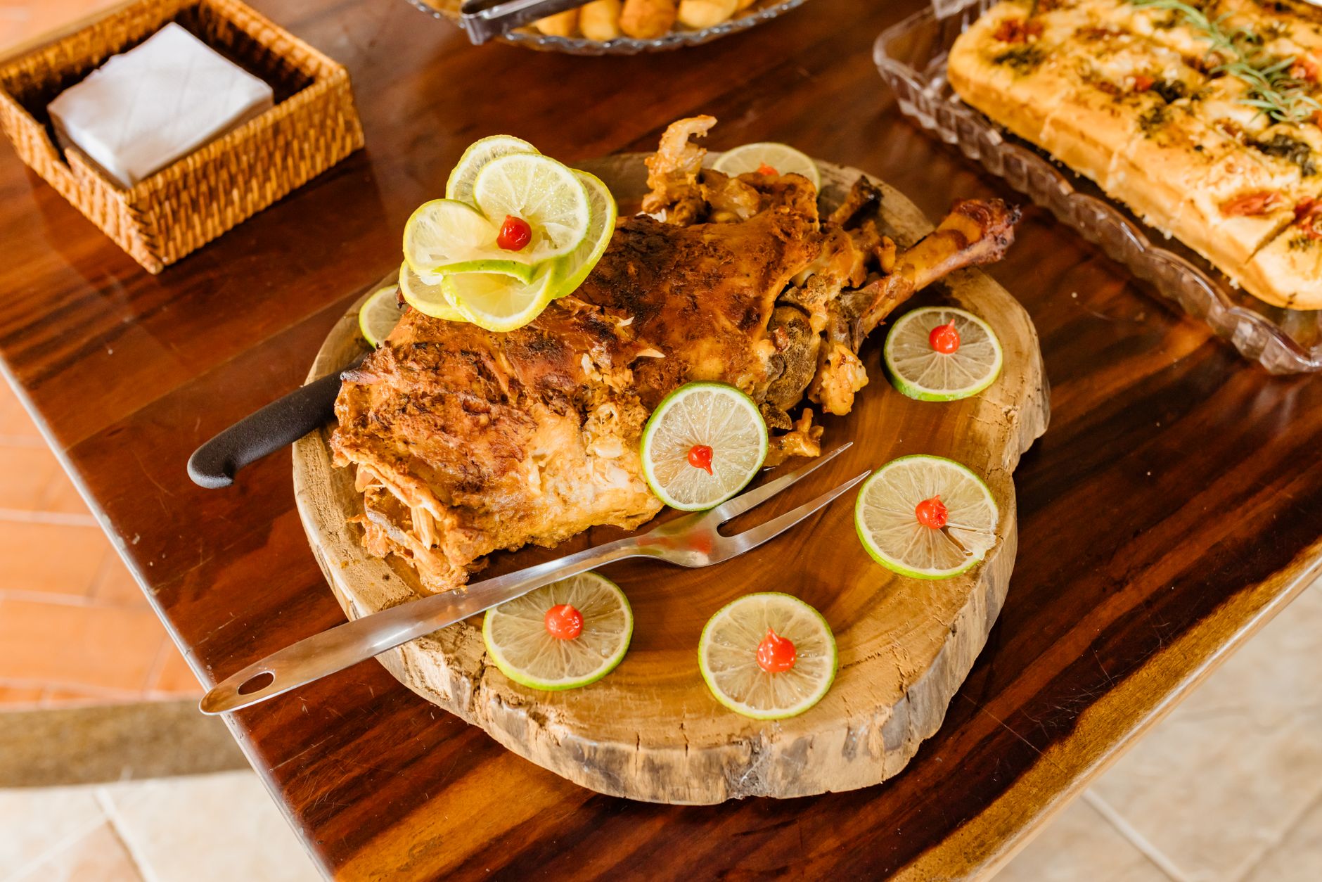
Whole Roast Lamb: Formerly a delicacy reserved for noble mansions and temple sacrifices, it uses a year‑old castrated lamb, stuffed with seasoning, slowly rotated over fruitwood fire for hours until the skin turns golden‑red and sizzles. The finished dish retains the lamb’s complete form; in Mongolian it is called zhaomu or xiusi. At the ceremonial cutting, the most respected person first offers the first slice to heaven and earth—a highly ritualised act.
Hohhot Shaomai (Steamed Dumplings): These date back to the tea houses of Guihua City in the Qing dynasty. Wrapped in paper‑thin dough, the filling is hand‑chopped mutton with scallions and fresh ginger, shaped like a pomegranate. When steamed, they are translucent; dip them hot in Shanxi aged vinegar and bite into a burst of juice. Two liang (100 g) of shaomai with a pot of brick tea is the morning ritual of Hohhot’s elders.
Wuchuan Oat Noodles (Youmian): Wuchuan County, at the northern foot of the Yin Mountains, is famous for its oats. Oat flour must undergo “three ripening steps”—roasting, scalding, and steaming. Skilled cooks roll the dough into paper‑thin cylinders or rub it into small fish‑shaped pellets, creating dozens of shapes (nests, fish, and squeezed noodles), served with a mutton sauce or cold dressed. Light and refreshing, they are hailed as “the secret to Inner Mongolians’ longevity.”
Milk Tea and Dairy Products: Mongolian milk tea is salty: brick tea is crumbled and boiled, then mixed with fresh milk, salt, butter, roasted millet, clotted cream, and cheese. The aromas of tea, milk, and toasted grain blend together. On a cold morning, a bowl of this tea can dispel the entire steppe’s chill.
Dining customs and regional character
There are no elaborate dining rituals on the steppe, but every custom reflects gratitude to heaven and earth. Upon entering a yurt, the host must first offer milk tea, using both hands or the right hand. When a distant guest arrives, a khada (ceremonial scarf) and horse‑milk wine are presented; the guest should dip the ring finger into the wine and flick it towards heaven, earth, and the ancestors, as a sign of respect. When eating hand‑held mutton, never point the knife at others, and cut the meat cleanly. Inner Mongolians are known for their hearty appetite—“drinking from large bowls and eating large chunks of meat”—yet they also embed subtlety in the everyday: a bowl of noodles or a flatbread carries flavours fermented by time. Like the plateau itself, they appear broad and open on the outside, yet are steady and resilient within.
Chapter 6: Modern and Contemporary Development

Inner Mongolia’s modern history is a narrative of transformation from a remote pastoral frontier to a national strategic hinterland, traced along four lines: border ports, steel, energy, and digitalisation.
Opening of ports and external engagement: from camel trails to international railways
At the end of the 19th century, the whistle of the Chinese Eastern Railway awakened the slumbering steppe. In 1897, Russia began building the railway, making Manzhouli and Hailar key nodes connecting to Siberia. Manzhouli Port was officially opened in 1901 and quickly rose to become a hub for Northeast Asian trade with Russia, later serving as a forward outpost for China’s “opening to the north.” After 1949, the Jining–Erenhot international railway, opened in 1956, connected to Mongolia’s Zamyn‑Üüd and Russia’s Ulan‑Ude, forming another trans‑Eurasian corridor. Today, Inner Mongolia has 20 open border ports—including Manzhouli, Erenhot, Ceke, and Ganqmod—accounting for nearly half of China’s land ports. Freight trains of the China‑Europe Railway Express roar out through Manzhouli and Erenhot, reviving this ancient steppe trade route in a modern “steel camel caravan.”
Industry and urban construction: chimneys rising on the grassland
If ports are the outward‑reaching tentacles, the First Five‑Year Plan was the inward foundation‑laying. In 1954, the state decided to build a large integrated steel enterprise in Baotou, and Baotou Steel became the first major industrial project in a minority region of New China. Shortly thereafter, Baotou No.1 Machinery and No.2 Machinery plants were completed, producing tanks and artillery. Baotou transformed from a fur distribution centre into a major heavy industrial city in northern China. At the same time, the Greater Khingan forest area, the Ordos coal base, and the Bayan Obo rare‑earth mine (the world’s largest rare‑earth deposit) were successively developed. Inner Mongolia established a complete industrial system in energy and raw materials, giving rise to an urban cluster: the Hohhot‑Baotou‑Ordos (Hubao‑E) region became the economic golden triangle of Inner Mongolia.
Transition since reform and opening up: from resource dependence to diversified advance
After reform and opening up, Ordos, relying on its four resources—“cashmere, coal, rare earth, and natural gas”—once created a growth miracle with per‑capita GDP surpassing that of Hong Kong, and the new Kangbashi district rose rapidly. However, the tides of the resource economy also prompted deep reflection on ecology and sustainable development. Over the past decade, Inner Mongolia has promoted clean and efficient coal use and R&D in rare‑earth new materials, while accelerating green energy deployment. In the heart of the Kubuqi Desert, rows of photovoltaic panels create a spectacular sight—generating electricity above, while growing grass and raising sheep below, forming a “sand‑solar complementary” desert‑control model. The Horinger New Area has clustered cloud computing centres for Alibaba, Huawei, and others; the “Cloud Valley” has taken shape, establishing its position as a national computing hub in the “East‑Data‑West‑Computing” strategy.
Current positioning and development direction
In the new era, Inner Mongolia’s strategic positioning has become increasingly clear: maintaining its dual roles as a “national base for energy and strategic resources” and a “base for green agricultural and livestock products,” reinforcing the “two barriers” of an important ecological security shield in northern China and a security and stability bulwark along the northern frontier, and building itself into a vital bridgehead for China’s opening to the north. “Ecological priority and green development” has become the guiding logic; over the past decade, the average grassland vegetation coverage has risen to 44%, areas like Ulan Buh have shrunk, and the water quality of the Yellow River passing through has continued to improve. Today, Hohhot is advancing towards becoming a modern regional central city, and Inner Mongolia as a whole is shifting from resource‑driven to innovation‑driven development, transitioning towards green growth while safeguarding national energy security.
Chapter 7: Transportation and Travel

On a territory of 1.18 million square kilometres, transportation not only carries communication but also frames the scale of understanding the world. For travellers, the roads of Inner Mongolia are themselves scenery and experience.
External transportation: gateways and arteries along the border
For international travel, Inner Mongolia has three major international air hubs—Hohhot Baita International Airport, Ordos Ejin Horo International Airport, and Manzhouli Xijiao Airport—operating direct cross‑border routes to Ulaanbaatar (Mongolia), Irkutsk (Russia), and beyond. Railway ports serve as the main arteries for bulk cargo: the Binzhou line exits via Manzhouli towards European Russia; the Jining‑Erenhot line exits via Erenhot, linking to Mongolia’s central railway and onward to Ulaanbaatar and Moscow. China‑Europe freight trains are marshalled and distributed here, while road ports such as Mandula and Ganqmod are the lifeblood of Sino‑Mongolian energy and mineral trade. Domestically, Hohhot is a comprehensive regional hub, with the Beijing‑Baotou, Baotou‑Lanzhou, Jining‑Tongliao, Hohhot‑Zhungeer‑Ordos, and Zhangjiakou‑Hohhot high‑speed railways interweaving to form fast corridors to Beijing (as fast as 2.5 hours), Xi’an, Taiyuan, and Yinchuan. The expressway network (G6, G7, G65, G18, etc.) connects all directions; a self‑drive from Beijing enters Inner Mongolia in about four hours.
Lifelines between leagues and cities
The east‑west straight‑line distance of the autonomous region exceeds 2,400 kilometres—driving from the easternmost Erguna to the westernmost Ejina takes nearly 30 hours. Thus, the aviation network is crucial: Hohhot has scheduled flights to Hailar, Manzhouli, Tongliao, Ulanhot, Xilinhot, Chifeng, Ordos, Bayannur, Wuhai, and Alxa Left Banner, basically guaranteeing same‑day inter‑city travel. The Hohhot‑Baotou‑Ordos trio has formed a “one‑hour living circle” with bullet trains; the Hohhot‑Zhungeer‑Ordos railway and intercity high‑speed trains tightly link the city cluster. For deeper exploration of the grassland hinterland, long‑distance buses and SUV self‑drives are the mainstream choices.
Unique travel experiences
Self‑driving is the best way to feel Inner Mongolia. Starting from Hailar, follow the China‑Russia border highway northwards: on the left, the winding Erguna River and Russian villages; on the right, birch forests and vast meadows—this road is called “China’s most beautiful border‑defence highway.” If you prefer rail romance, you can take the international passenger train from Hohhot via Jining to Erenhot (check schedules in advance), or switch to the Jining‑Tongliao line via Jingpeng. Though the era of steam locomotives is gone, the prairie railways still keep their own slow tempo. Of course, the most unforgettable experience is riding a horse against the wind—not as a means of transport but as an extension of the senses; only when the hooves touch the earth can you understand the symbiosis between Mongols and horses. Note that border areas require compliance with frontier regulations; some terrains use fixed cattle‑and‑sheep trails, so do not drive at will across the grassland.
Chapter 8: Travel Tips

Best travel seasons
Inner Mongolia has four distinct seasons, each with its own stunning appeal.
- Summer Green (June–August): The golden season for the grasslands, with temperatures of 15–28°C. The grass reaches knee‑height, wildflowers bloom everywhere, and Naadam festivals are concentrated in July and August—the perfect time to experience Mongolian culture. Book accommodation well in advance, especially in core grasslands like Hulun Buir and Xilingol.
- Autumn Gold (September–October): The Greater Khingan Range and Ejina’s poplar forests put on a spectacular colour show. The best viewing period for Ejina’s poplars is early to mid‑October—a mere 21 days; Arxan National Forest Park is like an oil painting, with gold and pine green interwoven, fewer crowds than summer, and pleasant temperatures.
- Winter White (December–February): Temperatures can plunge to −30°C to −40°C, especially in Genhe, Hulun Buir, known as “China’s Cold Pole.” In this icy wonderland, you can experience the Ice Naadam, watch Mongolian men lasso horses on snow, and join reindeer‑herding tribes’ parades. Winter offers a purer northern flavour, but you must be well‑protected against extreme cold, and vehicles need snow tyres.
- Spring Wind (April–May): Warmer but with frequent wind and dust, yet the grass begins to green and migratory birds pass through—ideal for bird‑watching and witnessing the desert’s revival.
Recommended must‑do experiences (overview)
- Hulun Buir Grassland heartland experience: The Morigele River winds like a khada scarf; stay in a yurt, ride horses with the wind, and gaze at the low‑hanging stars at night. Join a small Naadam, learn to make hand‑held mutton from herders—this is the highlight of your Inner Mongolia trip.
- Pilgrimage to Xanadu (Yuan Shangdu): On the Jinlianchuan grassland of Zhenglan Banner, Xilingol, climb the ruins now half‑covered by grass and feel the desolate grandeur of a World Heritage site. The museum’s illustrations from Marco Polo’s travels, juxtaposed with the crumbling walls, create a fold in history.
- Genghis Khan’s Mausoleum sacrifice: Located in Ejin Horo Banner, Ordos, the grand sacrifice at Chagan Suluk on the 21st day of the third lunar month is the most solemn—a solemn and magnificent scene that offers a glimpse into the Mongols’ deep reverence for their ancestors.
- Ejina Poplar Forest golden tour: One of only three remaining natural river‑bank poplar forests in the world. Its golden reflections in autumn, and the gnarled “strange forest” of dead yet undying trees, belong on every photographer’s bucket list.
- Arxan National Forest Park: At the southwestern foot of the Greater Khingan Range, this park features volcanic hot springs, crater lakes, and primeval forests. In a single day, you can traverse grasslands, forests, and volcanic landforms—especially beautiful in autumn.
Practical tips and precautions
- Climate and protection: Strong plateau sunlight and dry air make sunscreen, sunglasses, and lip balm essential. The large diurnal temperature range—“wear cotton in the morning and gauze at noon”—is real; even in summer, carry a light down jacket or a windbreaker.
- Mongolian etiquette: Never step on the threshold when entering a yurt; do not spit or throw rubbish into the hearth; accept the host’s khada and horse‑milk wine with both hands; do not raise your voice in front of elders. In temples, follow the clockwise visiting route and do not point at sacred statues.
- Transport and signals: Mobile phone signals in the grasslands are intermittent. Take photos of important junctions and download offline maps (Amap, Baidu) in advance. Some pastoral roads are unpaved and muddy after rain; an SUV is preferred. Be patient when encountering livestock crossing the road—do not honk to avoid startling them.
- Ecology protection: Do not drive over grasslands; damaging the turf incurs heavy compensation. Take all rubbish with you to preserve the pristine steppe. In border areas, drones are strictly prohibited; do not cross barbed‑wire fences. Some sections require registration at the border police station (e.g., Heishantou Town, Erguna)—check in advance.
- Diet and health: First‑time exposure to Mongolian food may cause digestive discomfort; eat milk tea and dairy products in moderation and drink plenty of boiled water. The hand‑held mutton is freshly slaughtered on‑site—if you cannot accept that, inform your host early. Bring some digestive medicines and plasters.
Inner Mongolia is not a destination for rushed check‑ins. Its vastness demands that you still your heart, measure the horizon with your eyes, and synchronise your breath and steps with the land. When you set foot on this plateau, you will find that the wind carries poetry, the grass has deep roots, and the people on horseback are smiling as they offer you a steaming bowl of milk tea.